Geolocate

Dodro topographic map

Click on the map to display elevation.

About this map

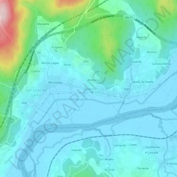
Name: Dodro topographic map, elevation, terrain.

Location: Dodro, Sar, La Coruña, Galicia, 15981, España (42.69567 -8.72428 42.73567 -8.68428)

Average elevation: 48 m

Minimum elevation: -4 m

Maximum elevation: 308 m

Gear up for your next adventure:

🥾Trail Running Shoes - Lightweight and durable shoes for trail running
🧰Multitool Knife - Compact and versatile tool for outdoor use
🔭Outdoor Binoculars - Lightweight binoculars for birdwatching and hiking
🗺️Topographic Maps - Detailed maps to explore trails, mountains, and wilderness areas
🌬️Windproof Camp Stove - Efficient cooking even on exposed mountain peaks

As an Amazon Associate, this site earns from qualifying purchases at no extra cost to you.