Geolocate

Kathleen topographic map

Click on the map to display elevation.

About this map

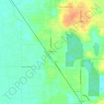
Name: Kathleen topographic map, elevation, terrain.

Location: Kathleen, Polk County, Florida, United States (28.09508 -82.05661 28.14606 -82.00662)

Average elevation: 46 m

Minimum elevation: 31 m

Maximum elevation: 73 m

Gear up for your next adventure:

🛶Kayak Dry Bag - Waterproof storage for kayaking adventures
🛌Down Sleeping Bag - Superior warmth-to-weight ratio for cold nights
🌬️Windproof Camp Stove - Efficient cooking even on exposed mountain peaks
🧦Hiking Socks - Moisture-wicking and comfortable socks for long hikes
🧴Waterproofing Spray - Restore the DWR coating on jackets and tents

As an Amazon Associate, this site earns from qualifying purchases at no extra cost to you.