Geolocate

Prussia topographic map

Click on the map to display elevation.

About this map

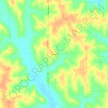
Name: Prussia topographic map, elevation, terrain.

Location: Prussia, Prussia Township, Adair County, Iowa, United States (41.35388 -94.52636 41.39388 -94.48636)

Average elevation: 402 m

Minimum elevation: 380 m

Maximum elevation: 423 m

Other topographic maps

Click on a map to view its topography, its elevation and its terrain.

Bridgewater

United States > Iowa > Adair County

Average elevation: 374 m

Greenfield

United States > Iowa > Adair County

Average elevation: 406 m

Adair

United States > Iowa > Adair County

Average elevation: 432 m

Bridgewater

United States > Iowa > Adair County

Average elevation: 374 m

Fontanelle

United States > Iowa > Adair County

Average elevation: 398 m

Orient

United States > Iowa > Adair County

Average elevation: 405 m

Stuart

United States > Iowa > Adair County

Average elevation: 364 m

Gear up for your next adventure:

🎒Fully Waterproof Backpack - Total protection for photography gear and electronics
👟Sport Hiking Sandals - Breathable footwear for water crossings and camp rest
🧊Insulated Water Bottle - Keeps drinks cold in summer and prevents freezing in winter
🧢Outdoor Cap - Protective cap for sun and rain during hikes
🕯️Camping Lantern - Illuminates your entire campsite with high-efficiency LEDs

As an Amazon Associate, this site earns from qualifying purchases at no extra cost to you.