
Thank you for supporting this site ❤️
Make a donation
Make a donation
Gear up for your next adventure:
As an Amazon Associate, this site earns from qualifying purchases at no extra cost to you.
Chalhuamayo topographic map
Click on the map to display elevation.
Thank you for supporting this site ❤️
Make a donation
Make a donation
Gear up for your next adventure:
As an Amazon Associate, this site earns from qualifying purchases at no extra cost to you.
About this map
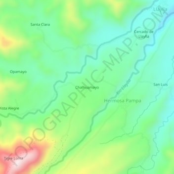
Name: Chalhuamayo topographic map, elevation, terrain.
Location: Chalhuamayo, Hermosa Pampa, Llaylla, Satipo, Junín, Perú (-11.41949 -74.62781 -11.37949 -74.58781)
Average elevation: 1,206 m
Minimum elevation: 1,051 m
Maximum elevation: 1,548 m
Thank you for supporting this site ❤️
Make a donation
Make a donation
Gear up for your next adventure:
As an Amazon Associate, this site earns from qualifying purchases at no extra cost to you.