Geolocate

Natividad topographic map

Click on the map to display elevation.

About this map

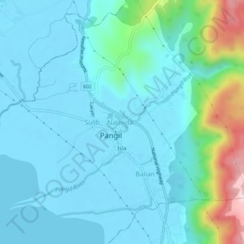
Name: Natividad topographic map, elevation, terrain.

Location: Natividad, Pangil, Laguna, Calabarzon, 4018, Philippines (14.38505 121.44966 14.42505 121.48966)

Average elevation: 70 m

Minimum elevation: -4 m

Maximum elevation: 440 m

Gear up for your next adventure:

🛁Quick-Dry Microfiber Towel - Space-saving towel that dries rapidly on the move
🧥Fleece Jacket - Warm and lightweight jacket for layering
🔭Outdoor Binoculars - Lightweight binoculars for birdwatching and hiking
🛌Insulated Sleeping Pad - Critical thermal barrier between you and the cold ground
🧥Waterproof Hiking Jacket - Protect yourself from rain and wind while hiking

As an Amazon Associate, this site earns from qualifying purchases at no extra cost to you.