
Thank you for supporting this site ❤️
Make a donation
Make a donation
Gear up for your next adventure:
As an Amazon Associate, this site earns from qualifying purchases at no extra cost to you.
Birmani topographic map
Click on the map to display elevation.
Thank you for supporting this site ❤️
Make a donation
Make a donation
Gear up for your next adventure:
As an Amazon Associate, this site earns from qualifying purchases at no extra cost to you.
About this map
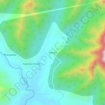
Name: Birmani topographic map, elevation, terrain.
Location: Birmani, Khed Taluka, Ratnagiri, Maharashtra, Inde (17.81242 73.54287 17.85242 73.58287)
Average elevation: 312 m
Minimum elevation: 97 m
Maximum elevation: 955 m
Thank you for supporting this site ❤️
Make a donation
Make a donation
Gear up for your next adventure:
As an Amazon Associate, this site earns from qualifying purchases at no extra cost to you.