Geolocate

West Point topographic map

Click on the map to display elevation.

About this map
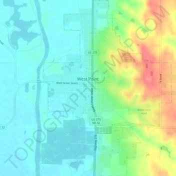
Name: West Point topographic map, elevation, terrain.

Location: West Point, Cuming County, Nebraska, 68788, United States (41.81860 -96.72538 41.85780 -96.68702)

Average elevation: 416 m

Minimum elevation: 393 m

Maximum elevation: 468 m

Gear up for your next adventure:

🥾Light Hiking Boots - Lightweight and comfortable boots for day hikes
🔨Vehicle Emergency Tool - Safety tool for remote road trips to trailheads
🔥Emergency Fire Starter - Reliable ignition source for all weather conditions
🔪Outdoor Multitool - Versatile tool for repairs and food prep in the wild
🧳Compression Sacks - Maximize space in your backpack by shrinking gear

As an Amazon Associate, this site earns from qualifying purchases at no extra cost to you.