
Thank you for supporting this site ❤️
Make a donation
Make a donation
Gear up for your next adventure:
As an Amazon Associate, this site earns from qualifying purchases at no extra cost to you.
Chaudapura topographic map
Click on the map to display elevation.
Thank you for supporting this site ❤️
Make a donation
Make a donation
Gear up for your next adventure:
As an Amazon Associate, this site earns from qualifying purchases at no extra cost to you.
About this map
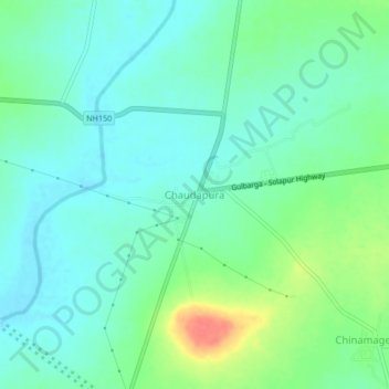
Name: Chaudapura topographic map, elevation, terrain.
Location: Chaudapura, Afzalpura taluku, Kalaburagi, Karnataka, India (17.21451 76.53325 17.25451 76.57325)
Average elevation: 417 m
Minimum elevation: 399 m
Maximum elevation: 466 m
Thank you for supporting this site ❤️
Make a donation
Make a donation
Gear up for your next adventure:
As an Amazon Associate, this site earns from qualifying purchases at no extra cost to you.