
Christian Valley topographic map
Click on the map to display elevation.
About this map
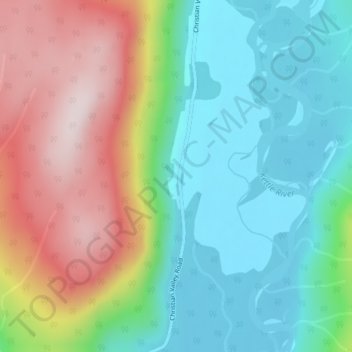
Name: Christian Valley topographic map, elevation, terrain.
Average elevation: 917 m
Minimum elevation: 743 m
Maximum elevation: 1,220 m
Other topographic maps
Click on a map to view its topography, its elevation and its terrain.
Idabel Lake
Canada > British Columbia > Regional District of Kootenay Boundary > Area E (Beaverdell/West Boundary)
Average elevation: 1,268 m
Stump Lake
Canada > British Columbia > Regional District of Kootenay Boundary > Area E (Beaverdell/West Boundary)
Average elevation: 1,321 m
Conkle Lake
Canada > British Columbia > Regional District of Kootenay Boundary > Area E (Beaverdell/West Boundary)
Average elevation: 1,221 m
Boundary Creek Provincial Park
Canada > British Columbia > Regional District of Kootenay Boundary > Area E (Beaverdell/West Boundary)
Average elevation: 879 m