
ولسوالی مرکز بهسود topographic map
Interactive map
Click on the map to display elevation.
About this map
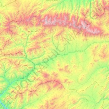
Name: ولسوالی مرکز بهسود topographic map, elevation, terrain.
Location: ولسوالی مرکز بهسود, Wardak, Afghanistan (34.12944 67.21517 34.68604 68.17048)
Average elevation: 3,245 m
Minimum elevation: 2,097 m
Maximum elevation: 5,054 m