Geolocate

Groningen topographic map

Click on the map to display elevation.

About this map

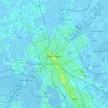
Name: Groningen topographic map, elevation, terrain.

Location: Groningen, Netherlands (53.17861 6.46275 53.26495 6.66687)

Average elevation: 1 m

Minimum elevation: -6 m

Maximum elevation: 12 m

Other topographic maps

Click on a map to view its topography, its elevation and its terrain.

Blokstad

Netherlands > Groningen > Appingedam

Average elevation: -1 m

Breede

Netherlands > Groningen > Warffum

Average elevation: 0 m

Nieuwklap

Netherlands > Groningen > Aduard

Average elevation: 1 m

Hoogwatum

Netherlands > Groningen > Bierum

Average elevation: 0 m

Marnehuizen

Netherlands > Groningen > Lauwersoog

Average elevation: -1 m

Gear up for your next adventure:

🧦Hiking Liner Socks - Thin base layer to prevent friction and blisters
🥾Hiking Shoes - Durable and comfortable shoes for trail hiking
🥫Freeze-Dried Meals - Lightweight, high-calorie nutrition for multi-day treks
🛏️Sleeping Bag - Warm and compact sleeping bags for outdoor camping
🛶Waterproof Dry Bags - Keep electronics and clothes dry during river crossings

As an Amazon Associate, this site earns from qualifying purchases at no extra cost to you.