Geolocate

Smiths Falls topographic map

Click on the map to display elevation.

About this map

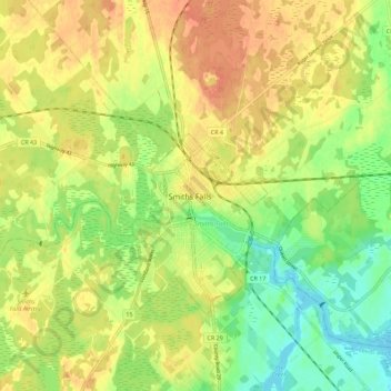
Name: Smiths Falls topographic map, elevation, terrain.

Location: Smiths Falls, Eastern Ontario, Ontario, K7A 2E5, Canada (44.86136 -76.05955 44.94136 -75.97955)

Average elevation: 125 m

Minimum elevation: 102 m

Maximum elevation: 143 m

Ontario trails, hiking, mountain biking, running and outdoor activities

Gear up for your next adventure:

💧Collapsible Water Bottle - Space-saving water bottle for outdoor activities
Bushcraft Tarp - Versatile emergency shelter or gear protection
🧥Ultralight Puffy Jacket - Maximum warmth that packs down to the size of an orange
👟Sport Hiking Sandals - Breathable footwear for water crossings and camp rest
🥾Waterproof Hiking Boots - Boots keeping your feet dry in wet conditions

As an Amazon Associate, this site earns from qualifying purchases at no extra cost to you.