Geolocate

la Tossa topographic map

Click on the map to display elevation.

About this map

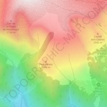
Name: la Tossa topographic map, elevation, terrain.

Location: la Tossa, Meranges, Cerdaña, Gerona, Cataluña, España (42.46223 1.76053 42.48223 1.78053)

Average elevation: 2,372 m

Minimum elevation: 1,784 m

Maximum elevation: 2,865 m

Other topographic maps

Click on a map to view its topography, its elevation and its terrain.

Estany de Malniu

España > Cataluña > Cerdaña > Meranges

Average elevation: 2,338 m

Gear up for your next adventure:

🔋Lithium AA Batteries - Long-lasting power that performs in extreme cold
💡Solar Camping Lamp - Eco-friendly lighting for campsites
🥾Waterproof Hiking Boots - Essential footwear for rugged terrain and wet Canadian trails
🥾Durable Hiking Shoes - Long-lasting shoes for frequent hiking
🎒Hiking Daypack - Lightweight and durable backpacks for day trips and excursions

As an Amazon Associate, this site earns from qualifying purchases at no extra cost to you.