
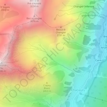
Cussunaz topographic map
Interactive map
Click on the map to display elevation.
About this map
Name: Cussunaz topographic map, elevation, terrain.
Location: Cussunaz, Chanavey, Rhêmes-Notre-Dame, Vallée d'Aoste, Italie (45.57887 7.10407 45.59887 7.12407)
Average elevation: 2,311 m
Minimum elevation: 1,600 m
Maximum elevation: 3,172 m
Other topographic maps
Click on a map to view its topography, its elevation and its terrain.
Bruil (Capoluogo)
Italie > Vallée d'Aoste > Chanavey
Bruil (Capoluogo), Chanavey, Rhêmes-Notre-Dame, Vallée d'Aoste, Italie
Average elevation: 2,211 m