
Thank you for supporting this site ❤️
Make a donation
Make a donation
Gear up for your next adventure:
As an Amazon Associate, this site earns from qualifying purchases at no extra cost to you.
Meran topographic map
Click on the map to display elevation.
Thank you for supporting this site ❤️
Make a donation
Make a donation
Gear up for your next adventure:
As an Amazon Associate, this site earns from qualifying purchases at no extra cost to you.
About this map
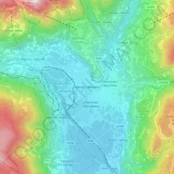
Name: Meran topographic map, elevation, terrain.
Location: Meran, Burggrafenamt, Bozen, Trentino-Südtirol, 39012, Italien (46.62955 11.11942 46.70955 11.19942)
Average elevation: 697 m
Minimum elevation: 262 m
Maximum elevation: 1,989 m
Thank you for supporting this site ❤️
Make a donation
Make a donation
Gear up for your next adventure:
As an Amazon Associate, this site earns from qualifying purchases at no extra cost to you.