Geolocate

Rhea topographic map

Click on the map to display elevation.

About this map

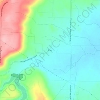
Name: Rhea topographic map, elevation, terrain.

Location: Rhea, Washington County, Arkansas, United States (35.99425 -94.42299 36.03425 -94.38299)

Average elevation: 375 m

Minimum elevation: 330 m

Maximum elevation: 485 m

Gear up for your next adventure:

🎒Fully Waterproof Backpack - Total protection for photography gear and electronics
🧥Softshell Hiking Jacket - The perfect balance of wind protection and breathability
🧥Waterproof Jacket - Lightweight rain jackets for hiking and outdoor activities
🦶Hiking Shoe Insoles - Added support for high arches and long days on feet
🧰Multitool Knife - Compact and versatile tool for outdoor use

As an Amazon Associate, this site earns from qualifying purchases at no extra cost to you.