

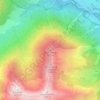
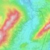
Hintersteiner Tal topographic map
Click on the map to display elevation.
About this map

Name: Hintersteiner Tal topographic map, elevation, terrain.
Average elevation: 1,400 m
Minimum elevation: 878 m
Maximum elevation: 2,039 m
Other topographic maps
Click on a map to view its topography, its elevation and its terrain.
Ostrach
Deutschland > Bayern > Landkreis Oberallgäu > Bad Hindelang
Liste der direkten Zuflüsse der Ostrach und ihrer beiden Oberläufe, jeweils von der Quelle bis zur Mündung. Mit Gewässerlänge, Einzugsgebiet und Höhe. Andere Quellen für die Angaben sind vermerkt.
Average elevation: 1,353 m
Vorderhindelang
Deutschland > Bayern > Landkreis Oberallgäu > Bad Hindelang
Average elevation: 1,034 m

Laufbacher Eck
Deutschland > Bayern > Landkreis Oberallgäu > Bad Hindelang
Das Laufbacher Eck ist ein 2178 m hoher Nebengipfel des Schnecks in den Allgäuer Alpen. Es hat den Charakter eines Grasbergs und liegt südöstlich des Lachenkopfs und nördlich des Rotkopfs, von dem er durch den Laufbacher-Eck-Sattel getrennt wird. Über diesen Sattel verläuft der Höhenweg vom…
Average elevation: 1,762 m

Krummenbach
Deutschland > Bayern > Landkreis Oberallgäu > Bad Hindelang > Unterjoch
Average elevation: 1,133 m
Untergschwend
Deutschland > Bayern > Landkreis Oberallgäu > Bad Hindelang > Unterjoch > Untergschwend
Average elevation: 1,185 m