Geolocate

Francisco topographic map

Click on the map to display elevation.

About this map

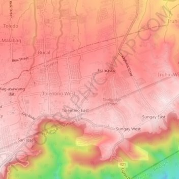
Name: Francisco topographic map, elevation, terrain.

Location: Francisco, Tagaytay, Cavite, Calabarzon, 4120, Philippines (14.11249 120.96295 14.15249 121.00295)

Average elevation: 512 m

Minimum elevation: 200 m

Maximum elevation: 608 m

Gear up for your next adventure:

💧Reusable Water Bottle - Durable water bottles for hydration on trails
👟Trail Running Shoes - Agile footwear for fast-paced topographic exploration
🔥Camping Stove - Portable stoves to cook outdoors with ease
🧼Travel Hand Sanitizer - Keep hands clean when water is scarce
🥾Mountain Hiking Boots - High-traction boots for rocky terrain

As an Amazon Associate, this site earns from qualifying purchases at no extra cost to you.