Geolocate

Meru topographic map

Click on the map to display elevation.

About this map

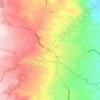
Name: Meru topographic map, elevation, terrain.

Location: Meru, Imenti North, Meru County, 60200, Kenya (0.02406 37.62446 0.09637 37.67444)

Average elevation: 1,591 m

Minimum elevation: 1,337 m

Maximum elevation: 1,830 m

Other topographic maps

Click on a map to view its topography, its elevation and its terrain.

Ntima East ward

Kenya > Meru County > Imenti North

Average elevation: 1,472 m

Kaaga

Kenya > Meru County > Imenti North > Nyaiki west ward

Average elevation: 1,609 m

Gear up for your next adventure:

🔋Solar Power Bank - Keep your GPS and devices charged during long outdoor trips
🔋Lithium AA Batteries - Long-lasting power that performs in extreme cold
🧣Evaporative Cooling Towel - Beat the heat during intense summer climbs
🛌Down Sleeping Bag - Superior warmth-to-weight ratio for cold nights
🥤Collapsible Travel Cup - Saves space and weight in your mess kit

As an Amazon Associate, this site earns from qualifying purchases at no extra cost to you.