Geolocate

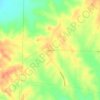
Patmos topographic map

Click on the map to display elevation.

About this map

Name: Patmos topographic map, elevation, terrain.

Location: Patmos, Hempstead County, Arkansas, 71801, United States (33.50907 -93.57239 33.51340 -93.56037)

Average elevation: 102 m

Minimum elevation: 85 m

Maximum elevation: 119 m

Other topographic maps

Click on a map to view its topography, its elevation and its terrain.
Columbus

United States > Arkansas > Hempstead County

Average elevation: 123 m

Gear up for your next adventure:

🧥Thermal Layer - Insulating layer for cold outdoor conditions
🧥Softshell Jacket - Windproof and breathable jacket for hiking
💧Collapsible Water Bottle - Space-saving water bottle for outdoor activities
❄️Traction Ice Cleats - Slip-on spikes for icy trails and winter hiking
🌡️Emergency Mylar Blankets - Compact thermal protection for unexpected nights outdoors

As an Amazon Associate, this site earns from qualifying purchases at no extra cost to you.