Geolocate

Caney City topographic map

Click on the map to display elevation.

About this map

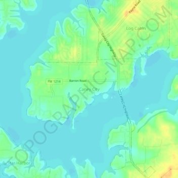
Name: Caney City topographic map, elevation, terrain.

Location: Caney City, Texas, 75148, United States (32.18869 -96.05431 32.22869 -96.01431)

Average elevation: 103 m

Minimum elevation: 95 m

Maximum elevation: 123 m

Gear up for your next adventure:

🛶Waterproof Dry Bags - Keep electronics and clothes dry during river crossings
🧼Biodegradable Camp Soap - Environmentally friendly cleaning for gear and body
🧥Thermal Fleece Jacket - Versatile insulation for changing mountain temperatures
Tent Footprint - Protect tent floor and increase durability
🦶Anti-Blister Balm - Prevents friction and hotspots during long ascents

As an Amazon Associate, this site earns from qualifying purchases at no extra cost to you.