

Make a donation
Gear up for your next adventure:
As an Amazon Associate, this site earns from qualifying purchases at no extra cost to you.
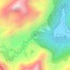
The Remarkables topographic map
Click on the map to display elevation.
Make a donation
Gear up for your next adventure:
As an Amazon Associate, this site earns from qualifying purchases at no extra cost to you.
The Remarkables
The area contains a number of beautiful features, such as Lake Alta, a small lake nestled within a natural amphitheatre at the head of a glacial valley (a ‘cirque’) and below the towering Double Cone peaks. There are a number of high altitude walks in the Remarkables Conservation Area including Lake Alta which can be accessed from the Remarkables Skifield.
Make a donation
Gear up for your next adventure:
As an Amazon Associate, this site earns from qualifying purchases at no extra cost to you.
About this map

Name: The Remarkables topographic map, elevation, terrain.
Location: The Remarkables, Queenstown-Lakes District, New Zealand (-45.12477 168.77909 -45.03326 168.80130)
Average elevation: 1,200 m
Minimum elevation: 301 m
Maximum elevation: 2,281 m
Make a donation
Gear up for your next adventure:
As an Amazon Associate, this site earns from qualifying purchases at no extra cost to you.
Other topographic maps
Click on a map to view its topography, its elevation and its terrain.

Make a donation
Gear up for your next adventure:
As an Amazon Associate, this site earns from qualifying purchases at no extra cost to you.


Make a donation
Gear up for your next adventure:
As an Amazon Associate, this site earns from qualifying purchases at no extra cost to you.


Make a donation
Gear up for your next adventure:
As an Amazon Associate, this site earns from qualifying purchases at no extra cost to you.



Make a donation
Gear up for your next adventure:
As an Amazon Associate, this site earns from qualifying purchases at no extra cost to you.

Make a donation
Gear up for your next adventure:
As an Amazon Associate, this site earns from qualifying purchases at no extra cost to you.

Make a donation
Gear up for your next adventure:
As an Amazon Associate, this site earns from qualifying purchases at no extra cost to you.