Geolocate

Soest topographic map

Click on the map to display elevation.

About this map

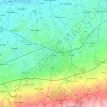
Name: Soest topographic map, elevation, terrain.

Location: Soest, Kreis Soest, North Rhine-Westphalia, 59494, Germany (51.52147 7.98314 51.62756 8.17620)

Average elevation: 121 m

Minimum elevation: 67 m

Maximum elevation: 268 m

Gear up for your next adventure:

🥾Mountaineering Boots - Supportive boots for climbing and high-altitude hiking
🧥Softshell Hiking Jacket - The perfect balance of wind protection and breathability
🏃Hydration Running Vest - Carry water and maps close to your body for speed
🥾Durable Hiking Shoes - Long-lasting shoes for frequent hiking
💡LED Camping Lantern - Illuminate your campsite with long-lasting lanterns

As an Amazon Associate, this site earns from qualifying purchases at no extra cost to you.