Geolocate

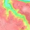
78930 topographic map

Click on the map to display elevation.

About this map

Name: 78930 topographic map, elevation, terrain.

Location: 78930, Guerville, Mantes-la-Jolie, Yvelines, Île-de-France, France métropolitaine, France (48.90709 1.65952 48.97781 1.78484)

Average elevation: 101 m

Minimum elevation: 16 m

Maximum elevation: 168 m

Other topographic maps

Click on a map to view its topography, its elevation and its terrain.
Senneville

France > Île-de-France > Yvelines > Guerville

Average elevation: 117 m

Gear up for your next adventure:

🧢Hiking Sun Hat - Wide-brimmed protection for exposed mountain ridges
🧴Insect Repellent - Protect yourself from bugs during outdoor adventures
🧤Thermal Hiking Gloves - Grip-enhanced gloves for cold-weather altitude trekking
💡LED Headlamp - Hands-free illumination for night hiking and camping
🛶Kayak Accessories - Essential gear for safe and fun kayaking adventures

As an Amazon Associate, this site earns from qualifying purchases at no extra cost to you.