Geolocate

Alton topographic map

Click on the map to display elevation.

About this map

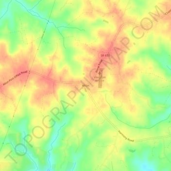
Name: Alton topographic map, elevation, terrain.

Location: Alton, Halifax County, Virginia, 24520, United States (36.55320 -79.02279 36.59320 -78.98279)

Average elevation: 156 m

Minimum elevation: 123 m

Maximum elevation: 179 m

Gear up for your next adventure:

🔋Lithium AA Batteries - Long-lasting power that performs in extreme cold
🥤Collapsible Travel Cup - Saves space and weight in your mess kit
🔋Solar Power Bank - Keep your GPS and devices charged during long outdoor trips
🎒Backpack Rain Cover - External shield to keep your entire pack dry
🥾Trail Hiking Boots - Supportive boots for rough trails

As an Amazon Associate, this site earns from qualifying purchases at no extra cost to you.