Geolocate

Upong topographic map

Click on the map to display elevation.

About this map

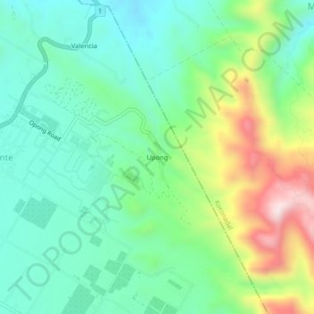
Name: Upong topographic map, elevation, terrain.

Location: Upong, Banga, South Cotabato, Soccsksargen, 9511, Philippines (6.42877 124.79338 6.46877 124.83338)

Average elevation: 261 m

Minimum elevation: 108 m

Maximum elevation: 609 m

Gear up for your next adventure:

🧳Compression Sacks - Maximize space in your backpack by shrinking gear
🐕Hiking Dog Pack - Let your canine companion carry their own water and food
🧭GPS Tracker - Track your location in remote areas safely
🧰Survival Kit - Essential gear for emergencies in the wilderness
🛰️Satellite Messenger - Emergency communication for areas with no cell service

As an Amazon Associate, this site earns from qualifying purchases at no extra cost to you.