
Bise topographic map
Click on the map to display elevation.
About this map
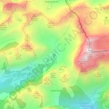
Name: Bise topographic map, elevation, terrain.
Average elevation: 1,768 m
Minimum elevation: 1,233 m
Maximum elevation: 2,394 m
Other topographic maps
Click on a map to view its topography, its elevation and its terrain.
Refuge de Trébentaz
France > Auvergne-Rhône-Alpes > Haute-Savoie > La Chapelle-d'Abondance > Le Clos
Average elevation: 1,740 m
Lac d'Arvouin
France > Auvergne-Rhône-Alpes > Haute-Savoie > La Chapelle-d'Abondance
Average elevation: 1,658 m