Geolocate

Laguilayan topographic map

Click on the map to display elevation.

About this map

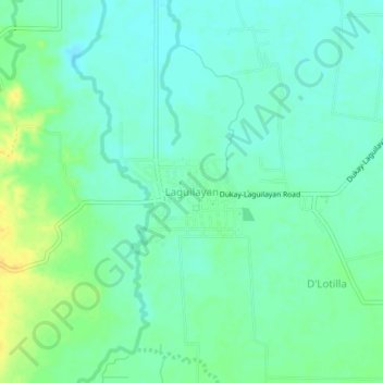
Name: Laguilayan topographic map, elevation, terrain.

Location: Laguilayan, Sultan Kudarat, Soccsksargen, 9805, Philippines (6.65065 124.50490 6.69065 124.54490)

Average elevation: 54 m

Minimum elevation: 45 m

Maximum elevation: 71 m

Other topographic maps

Click on a map to view its topography, its elevation and its terrain.

Columbio

Philippines > Sultan Kudarat

Average elevation: 268 m

Kapingkong River

Philippines > Sultan Kudarat > Sampao

Average elevation: 61 m

Lutayan

Philippines > Sultan Kudarat

Average elevation: 73 m

Kabulnan River

Philippines > Sultan Kudarat

Average elevation: 591 m

Gear up for your next adventure:

❄️Traction Ice Cleats - Slip-on spikes for icy trails and winter hiking
💡Solar Camping Lamp - Eco-friendly lighting for campsites
🧣Merino Neck Gaiter - Protects against wind, sun, and cold at high altitudes
🗺️Topographic Maps - Detailed maps to explore trails, mountains, and wilderness areas
🥾Waterproof Hiking Boots - Essential footwear for rugged terrain and wet Canadian trails

As an Amazon Associate, this site earns from qualifying purchases at no extra cost to you.