Geolocate

Sannidal topographic map

Click on the map to display elevation.

About this map

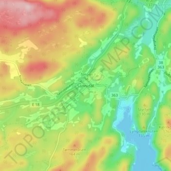
Name: Sannidal topographic map, elevation, terrain.

Location: Sannidal, Kragerø, Telemark, 3766, Norway (58.87582 9.26477 58.91582 9.30477)

Average elevation: 100 m

Minimum elevation: -1 m

Maximum elevation: 232 m

Gear up for your next adventure:

🧴Waterproofing Spray - Restore the DWR coating on jackets and tents
🧤Thermal Hiking Gloves - Grip-enhanced gloves for cold-weather altitude trekking
🧊Portable Cooler - Keep food and drinks cold during outdoor adventures
🧭GPS Handheld Device - Reliable GPS navigation for outdoor adventures
🔭Compact Binoculars - Lightweight optics for scouting trails and wildlife

As an Amazon Associate, this site earns from qualifying purchases at no extra cost to you.