
Thank you for supporting this site ❤️
Make a donation
Make a donation
Gear up for your next adventure:
As an Amazon Associate, this site earns from qualifying purchases at no extra cost to you.
Nagalamadike topographic map
Click on the map to display elevation.
Thank you for supporting this site ❤️
Make a donation
Make a donation
Gear up for your next adventure:
As an Amazon Associate, this site earns from qualifying purchases at no extra cost to you.
About this map
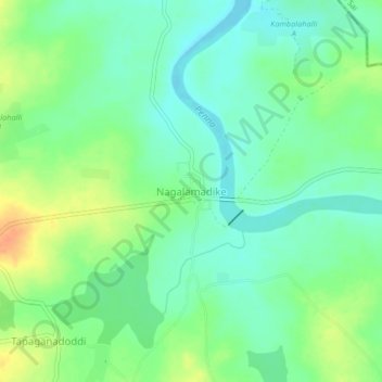
Name: Nagalamadike topographic map, elevation, terrain.
Location: Nagalamadike, Pavagada taluk, Tumakuru, Karnataka, India (14.16676 77.34803 14.20676 77.38803)
Average elevation: 561 m
Minimum elevation: 547 m
Maximum elevation: 585 m
Thank you for supporting this site ❤️
Make a donation
Make a donation
Gear up for your next adventure:
As an Amazon Associate, this site earns from qualifying purchases at no extra cost to you.