Geolocate

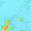
Vigonza topographic map

Click on the map to display elevation.

About this map

Name: Vigonza topographic map, elevation, terrain.

Location: Vigonza, Province of Padua, Veneto, 35010, Italy (45.41453 11.93092 45.49480 12.02723)

Average elevation: 10 m

Minimum elevation: 3 m

Maximum elevation: 18 m

Other topographic maps

Click on a map to view its topography, its elevation and its terrain.

San Biagio

Italy > Veneto > Province of Padua

Average elevation: 25 m

Monterosso

Italy > Veneto > Province of Padua > Abano Terme

Average elevation: 17 m

Taggì di Sopra

Italy > Veneto > Province of Padua

Average elevation: 18 m

Bosco

Italy > Veneto > Province of Padua > Rubano

Average elevation: 17 m

Perarolo

Italy > Veneto > Province of Padua > Vigonza

Average elevation: 9 m

Bosco

Italy > Veneto > Province of Padua > Rubano

Average elevation: 17 m

Capriccio

Italy > Veneto > Province of Padua > Vigonza

Average elevation: 9 m

Gear up for your next adventure:

🧭Orienteering Kit - Tools for map reading and navigation in the wild
🥾Mountain Hiking Shoes - Shoes with superior grip for mountainous terrain
💡LED Camping Lantern - Illuminate your campsite with long-lasting lanterns
🥾Light Hiking Boots - Lightweight and comfortable boots for day hikes
💡Compact LED Flashlight - Powerful and portable flashlight for outdoor use

As an Amazon Associate, this site earns from qualifying purchases at no extra cost to you.