Geolocate

Dhaara topographic map

Click on the map to display elevation.

About this map

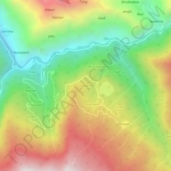
Name: Dhaara topographic map, elevation, terrain.

Location: Dhaara, Neuli, Sainj, Kullu, Himachal Pradesh, India (31.74170 77.35518 31.78170 77.39518)

Average elevation: 2,038 m

Minimum elevation: 1,445 m

Maximum elevation: 2,746 m

Gear up for your next adventure:

🧴Insect Repellent - Protect yourself from bugs during outdoor adventures
🧦Outdoor Socks - Durable socks designed for hiking and outdoor sports
🧥Waterproof Jacket - Lightweight rain jackets for hiking and outdoor activities
🥾Approach Shoes - Shoes designed for climbing approaches and rugged trails
🧭GPS Tracker - Track your location in remote areas safely

As an Amazon Associate, this site earns from qualifying purchases at no extra cost to you.