
Thank you for supporting this site ❤️
Make a donation
Make a donation
Gear up for your next adventure:
As an Amazon Associate, this site earns from qualifying purchases at no extra cost to you.
Ponte topographic map
Click on the map to display elevation.
Thank you for supporting this site ❤️
Make a donation
Make a donation
Gear up for your next adventure:
As an Amazon Associate, this site earns from qualifying purchases at no extra cost to you.
About this map
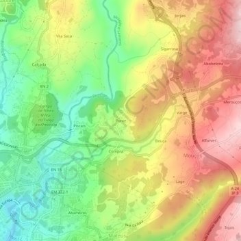
Name: Ponte topographic map, elevation, terrain.
Location: Ponte, Mouçós e Lamares, Vila Real, 5000-355, Portugal (41.29973 -7.73153 41.33973 -7.69153)
Average elevation: 536 m
Minimum elevation: 386 m
Maximum elevation: 697 m
Thank you for supporting this site ❤️
Make a donation
Make a donation
Gear up for your next adventure:
As an Amazon Associate, this site earns from qualifying purchases at no extra cost to you.