Geolocate

Hebelei topographic map

Click on the map to display elevation.

About this map

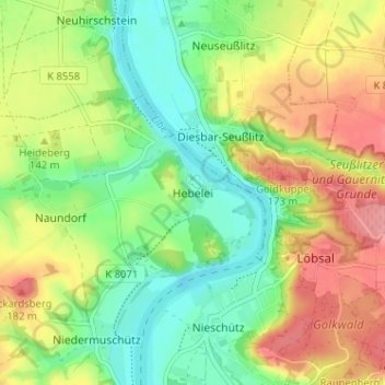
Name: Hebelei topographic map, elevation, terrain.

Location: Hebelei, Diera-Zehren, Meißen, Sachsen, Deutschland (51.21430 13.39360 51.25430 13.43360)

Average elevation: 132 m

Minimum elevation: 90 m

Maximum elevation: 186 m

Gear up for your next adventure:

🥾Mountaineering Boots - Supportive boots for climbing and high-altitude hiking
🧥Softshell Hiking Jacket - The perfect balance of wind protection and breathability
👟Sport Hiking Sandals - Breathable footwear for water crossings and camp rest
🛶Kayak Dry Bag - Waterproof storage for kayaking adventures
🔋Emergency Crank Radio - Weather alerts and power without needing batteries

As an Amazon Associate, this site earns from qualifying purchases at no extra cost to you.