Geolocate

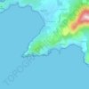
20130 topographic map

Click on the map to display elevation.

About this map

Name: 20130 topographic map, elevation, terrain.

Location: 20130, Cargèse, Ajaccio, Corse-du-Sud, Corse, France métropolitaine, France (42.11687 8.55804 42.19630 8.68872)

Average elevation: 181 m

Minimum elevation: -2 m

Maximum elevation: 1,040 m

Other topographic maps

Click on a map to view its topography, its elevation and its terrain.
Lozzi

France > Corse > Corse-du-Sud > Cargèse

Average elevation: 142 m

Cargèse

France > Corse > Corse-du-Sud > Cargèse

Son territoire est la terminaison en mer, à la punta Cargèse, d'un chaînon secondaire articulé à la pointe de Cricche (2 053 m d'altitude, sommet « à cheval » sur Ota et Albertacce) sur la chaîne principale de l'île, une ligne où s'élèvent les plus hauts sommets qui constituent une véritable…

Average elevation: 32 m

Gear up for your next adventure:

🛶Kayak Accessories - Essential gear for safe and fun kayaking adventures
⛺Camping Groundsheet - Protect your tent from moisture and dirt
🍽️Titanium Camping Spork - Ultralight and indestructible eating utensil
🛏️Sleeping Bag - Warm and compact sleeping bags for outdoor camping
🗺️Topographic Maps - Detailed maps to explore trails, mountains, and wilderness areas

As an Amazon Associate, this site earns from qualifying purchases at no extra cost to you.