Geolocate

Monte Serro topographic map

Click on the map to display elevation.

About this map

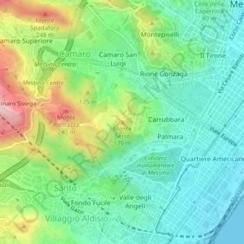
Name: Monte Serro topographic map, elevation, terrain.

Location: Monte Serro, Messina, Sicily, 98149, Italy (38.18064 15.53655 38.18074 15.53665)

Average elevation: 92 m

Minimum elevation: 0 m

Maximum elevation: 290 m

Gear up for your next adventure:

💡Compact LED Flashlight - Powerful and portable flashlight for outdoor use
🥾Light Trekking Boots - Supportive boots for multi-day treks
🗺️Topographic Maps - Detailed maps to explore trails, mountains, and wilderness areas
💧Reusable Water Bottle - Durable water bottles for hydration on trails
🥾All-Terrain Hiking Boots - Versatile boots for varied hiking conditions

As an Amazon Associate, this site earns from qualifying purchases at no extra cost to you.