Geolocate

Cawas topographic map

Click on the map to display elevation.

About this map

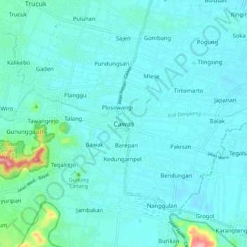
Name: Cawas topographic map, elevation, terrain.

Location: Cawas, Klaten, Central Java, Java, 57463, Indonesia (-7.80064 110.65668 -7.72064 110.73668)

Average elevation: 109 m

Minimum elevation: 94 m

Maximum elevation: 220 m

Other topographic maps

Click on a map to view its topography, its elevation and its terrain.

Kemalang

Indonesia > Central Java > Klaten

Average elevation: 844 m

Jaten

Indonesia > Central Java > Klaten

Average elevation: 117 m

Bendo

Indonesia > Central Java > Klaten

Average elevation: 110 m

Sajen

Indonesia > Central Java > Klaten

Average elevation: 105 m

Bulan

Indonesia > Central Java > Klaten

Average elevation: 120 m

Depra Sentono

Indonesia > Central Java > Klaten

Average elevation: 102 m

Pugeran

Indonesia > Central Java > Klaten

Average elevation: 97 m

Sidorejo

Indonesia > Central Java > Klaten

Average elevation: 1,110 m

Taji

Indonesia > Central Java > Klaten

Average elevation: 96 m

RT 11

Indonesia > Central Java > Klaten

Average elevation: 97 m

Gear up for your next adventure:

🧊Portable Cooler - Keep food and drinks cold during outdoor adventures
🥾Mountain Hiking Shoes - Shoes with superior grip for mountainous terrain
🧦Hiking Socks - Moisture-wicking and comfortable socks for long hikes
🧢Outdoor Visor - Breathable visor for sunny hikes
🧢Hiking Hat - Sun-protective and breathable hats for long treks

As an Amazon Associate, this site earns from qualifying purchases at no extra cost to you.