Geolocate

Arlington topographic map

Click on the map to display elevation.

About this map

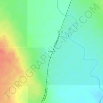
Name: Arlington topographic map, elevation, terrain.

Location: Arlington, Kiowa County, Colorado, United States (38.31669 -103.36422 38.35669 -103.32422)

Average elevation: 1,296 m

Minimum elevation: 1,277 m

Maximum elevation: 1,332 m

Other topographic maps

Click on a map to view its topography, its elevation and its terrain.

Eads

United States > Colorado > Kiowa County

Average elevation: 1,286 m

Sheridan Lake

United States > Colorado > Kiowa County

Average elevation: 1,240 m

Sheridan Lake

United States > Colorado > Kiowa County

Average elevation: 1,239 m

Gear up for your next adventure:

🔋Solar Power Bank - Keep your GPS and devices charged during long outdoor trips
🔦UV Flashlight - Detect minerals or specific insects in the dark
💧Hydration Bladder - Hands-free hydration solution for long treks
🧥Waterproof Pants - Keep dry during rainy hiking conditions
🦟Insect Repellent - Keep mosquitoes and black flies away in wooded areas

As an Amazon Associate, this site earns from qualifying purchases at no extra cost to you.