Geolocate

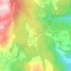
Oia topographic map

Click on the map to display elevation.

About this map

Name: Oia topographic map, elevation, terrain.

Location: Oia, Bajo Miño, Pontevedra, Galicia, España (41.95987 -8.89866 42.10390 -8.78441)

Average elevation: 200 m

Minimum elevation: -1 m

Maximum elevation: 650 m

Other topographic maps

Click on a map to view its topography, its elevation and its terrain.

O Hospital

España > Galicia > Bajo Miño

Average elevation: 66 m

Luneda

España > Galicia > Bajo Miño

Average elevation: 188 m

Sobrada

España > Galicia > Bajo Miño

Average elevation: 52 m

Santa Trega

España > Galicia > Bajo Miño > A Guarda

Average elevation: 27 m

Vilapouca

España > Galicia > Bajo Miño > Tuy

Average elevation: 152 m

Vilachán do Monte

España > Galicia > Bajo Miño > Tomiño

Average elevation: 340 m

Torrón

España > Galicia > Bajo Miño

Average elevation: 40 m

O Arrabal

España > Galicia > Bajo Miño > Tuy

Average elevation: 44 m

A Estación

España > Galicia > Bajo Miño > Tuy

Average elevation: 38 m

Cristelos

España > Galicia > Bajo Miño

Average elevation: 262 m

Alto da Portela

España > Galicia > Bajo Miño

Average elevation: 154 m

Bonaval

España > Galicia > Bajo Miño

Average elevation: 328 m

Vilariño

España > Galicia > Bajo Miño

Average elevation: 353 m

Toiberde

España > Galicia > Bajo Miño

Average elevation: 102 m

Gear up for your next adventure:

⛺Tent Footprint - Protect tent floor and increase durability
💧Filtered Water Bottle - Safe drinking water on the go
💡Solar Camping Lamp - Eco-friendly lighting for campsites
🛌Insulated Sleeping Pad - Critical thermal barrier between you and the cold ground
🍽️Titanium Camping Spork - Ultralight and indestructible eating utensil

As an Amazon Associate, this site earns from qualifying purchases at no extra cost to you.