Geolocate

Doniños topographic map

Click on the map to display elevation.

About this map

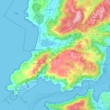
Name: Doniños topographic map, elevation, terrain.

Location: Doniños, Ferrol, La Coruña, Galicia, 15593, España (43.45319 -8.34810 43.51738 -8.26015)

Average elevation: 73 m

Minimum elevation: -8 m

Maximum elevation: 291 m

Other topographic maps

Click on a map to view its topography, its elevation and its terrain.

Vila Xorxe

España > Galicia > Ferrol > Ferrol

Average elevation: 84 m

Gear up for your next adventure:

🔋Solar Power Bank - Keep your GPS and devices charged during long outdoor trips
🥾Trail Running Shoes - Lightweight and durable shoes for trail running
💡Portable Camping Lamp - Rechargeable lamp for campsite lighting
🥾Trail Hiking Shoes - Durable shoes designed for rugged trails
💧Filtered Water Bottle - Safe drinking water on the go

As an Amazon Associate, this site earns from qualifying purchases at no extra cost to you.