Geolocate

Ceri topographic map

Click on the map to display elevation.

About this map

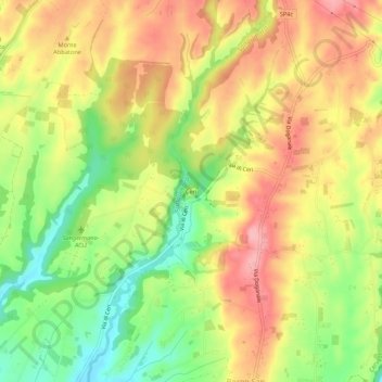
Name: Ceri topographic map, elevation, terrain.

Location: Ceri, Cerveteri, Roma Capitale, Lazio, Italy (41.97506 12.13336 42.01506 12.17336)

Average elevation: 111 m

Minimum elevation: 46 m

Maximum elevation: 167 m

Gear up for your next adventure:

Camping Essentials - All-in-one gear for a comfortable camping trip
Tent Footprint - Protect tent floor and increase durability
🧊Portable Cooler - Keep food and drinks cold during outdoor adventures
🔋Emergency Crank Radio - Weather alerts and power without needing batteries
🛶Kayak Dry Bag - Waterproof storage for kayaking adventures

As an Amazon Associate, this site earns from qualifying purchases at no extra cost to you.