
Make a donation
Gear up for your next adventure:
As an Amazon Associate, this site earns from qualifying purchases at no extra cost to you.
Westscheid topographic map
Click on the map to display elevation.
Make a donation
Gear up for your next adventure:
As an Amazon Associate, this site earns from qualifying purchases at no extra cost to you.
About this map
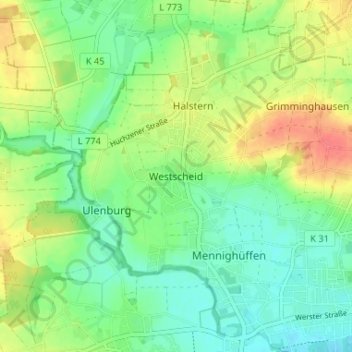
Name: Westscheid topographic map, elevation, terrain.
Average elevation: 73 m
Minimum elevation: 51 m
Maximum elevation: 109 m
Make a donation
Gear up for your next adventure:
As an Amazon Associate, this site earns from qualifying purchases at no extra cost to you.
Other topographic maps
Click on a map to view its topography, its elevation and its terrain.
Obernbeck
Deutschland > Nordrhein-Westfalen > Kreis Herford > Löhne
Obernbeck hat etwa 5.800 Einwohner und liegt am Nordufer der Werre. Das Gelände erhebt sich im Westen mit dem Höhenzug der Egge stark ansteigend, weiter östlich eher sanft aus der Flussniederung. Ortsteile sind Obernbeck (Mitte), Feld und Ellerbusch. Der benachbarte offizielle Stadtteil Ulenburg mit seinen…
Average elevation: 65 m
Wasserschloss Ulenburg
Deutschland > Nordrhein-Westfalen > Kreis Herford > Löhne > Westscheid
Average elevation: 73 m
Make a donation
Gear up for your next adventure:
As an Amazon Associate, this site earns from qualifying purchases at no extra cost to you.