
Naast topographic map
Interactive map
Click on the map to display elevation.
About this map
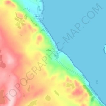
Name: Naast topographic map, elevation, terrain.
Location: Naast, Highland, Écosse, IV22 2LL, Royaume-Uni (57.76711 -5.67830 57.80711 -5.63830)
Average elevation: 77 m
Minimum elevation: 0 m
Maximum elevation: 220 m
Other topographic maps
Click on a map to view its topography, its elevation and its terrain.
Scottish Highlands
Royaume-Uni > Écosse > Highland
Scottish Highlands, Highland, Écosse, Royaume-Uni
Average elevation: 907 m