
Thank you for supporting this site ❤️
Make a donation
Make a donation
Gear up for your next adventure:
As an Amazon Associate, this site earns from qualifying purchases at no extra cost to you.
Narlık topographic map
Click on the map to display elevation.
Thank you for supporting this site ❤️
Make a donation
Make a donation
Gear up for your next adventure:
As an Amazon Associate, this site earns from qualifying purchases at no extra cost to you.
About this map
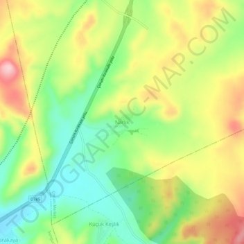
Name: Narlık topographic map, elevation, terrain.
Location: Narlık, Çorum Merkez, Çorum, Zwarte Zeeregio, Turkije (40.25619 34.63146 40.29619 34.67146)
Average elevation: 1,100 m
Minimum elevation: 1,005 m
Maximum elevation: 1,219 m
Thank you for supporting this site ❤️
Make a donation
Make a donation
Gear up for your next adventure:
As an Amazon Associate, this site earns from qualifying purchases at no extra cost to you.