Geolocate

Marguns topographic map

Click on the map to display elevation.

About this map

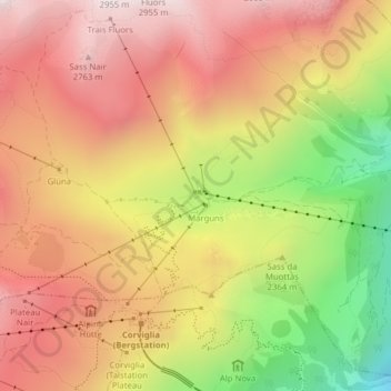
Name: Marguns topographic map, elevation, terrain.

Location: Marguns, Celerina/Schlarigna, Maloja, Grisons, 7500, Switzerland (46.50646 9.81473 46.52646 9.83473)

Average elevation: 2,413 m

Minimum elevation: 1,845 m

Maximum elevation: 2,814 m

Gear up for your next adventure:

🚲Bike Repair Kit - Essential tools for on-trail mechanical issues
🚲Heavy Duty Bike Lock - Secure your bike at the trailhead or during stops
🪑Insulated Seat Pad - Protect your seat from cold rocks and wet logs
🔋Emergency Crank Radio - Weather alerts and power without needing batteries
🛶Canoe Life Vest - Safety vest for water sports

As an Amazon Associate, this site earns from qualifying purchases at no extra cost to you.