Geolocate

Pattemouche topographic map

Click on the map to display elevation.

About this map

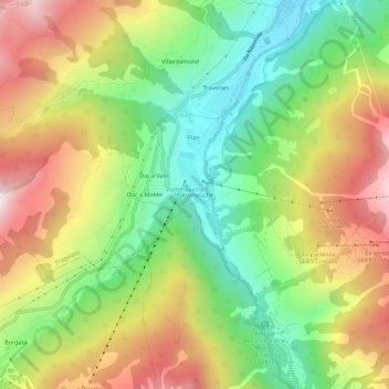
Name: Pattemouche topographic map, elevation, terrain.

Location: Pattemouche, Pragelato, Torino, Piedmont, 10058, Italy (44.96676 6.89967 45.00676 6.93967)

Average elevation: 1,912 m

Minimum elevation: 1,529 m

Maximum elevation: 2,387 m

Gear up for your next adventure:

🛶Kayak Dry Bag - Waterproof storage for kayaking adventures
🧰Survival Kit - Essential gear for emergencies in the wilderness
🥫Freeze-Dried Meals - Lightweight, high-calorie nutrition for multi-day treks
🥾All-Terrain Hiking Boots - Versatile boots for varied hiking conditions
🛶Canoe Life Vest - Safety vest for water sports

As an Amazon Associate, this site earns from qualifying purchases at no extra cost to you.