
Thank you for supporting this site ❤️
Make a donation
Make a donation
Gear up for your next adventure:
As an Amazon Associate, this site earns from qualifying purchases at no extra cost to you.
Lurtigen topographic map
Click on the map to display elevation.
Thank you for supporting this site ❤️
Make a donation
Make a donation
Gear up for your next adventure:
As an Amazon Associate, this site earns from qualifying purchases at no extra cost to you.
About this map
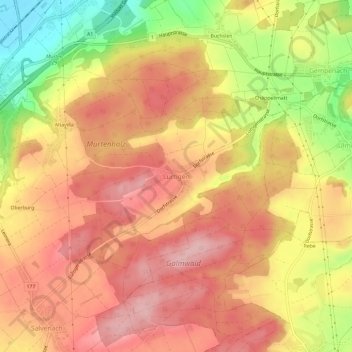
Name: Lurtigen topographic map, elevation, terrain.
Location: Lurtigen, Murten, See District, Fribourg, 3215, Switzerland (46.90857 7.15226 46.94857 7.19226)
Average elevation: 541 m
Minimum elevation: 431 m
Maximum elevation: 606 m
Thank you for supporting this site ❤️
Make a donation
Make a donation
Gear up for your next adventure:
As an Amazon Associate, this site earns from qualifying purchases at no extra cost to you.