Geolocate

Blanc topographic map

Click on the map to display elevation.

About this map

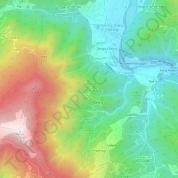
Name: Blanc topographic map, elevation, terrain.

Location: Blanc, San Germano Chisone, Turin, Piedmont, 10065, Italy (44.86465 7.21387 44.90465 7.25387)

Average elevation: 831 m

Minimum elevation: 432 m

Maximum elevation: 1,511 m

Gear up for your next adventure:

🗺️Topographic Maps - Detailed maps to explore trails, mountains, and wilderness areas
🔋Lithium AA Batteries - Long-lasting power that performs in extreme cold
🛶Waterproof Dry Bags - Keep electronics and clothes dry during river crossings
🧦Outdoor Socks - Durable socks designed for hiking and outdoor sports
🥾Trail Hiking Socks - Comfortable socks to prevent blisters and fatigue

As an Amazon Associate, this site earns from qualifying purchases at no extra cost to you.