Geolocate

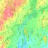
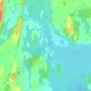
Trent River topographic map

Click on the map to display elevation.

About this map
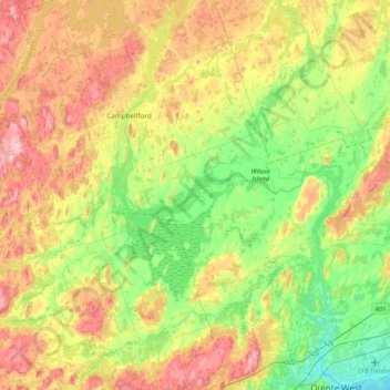
Name: Trent River topographic map, elevation, terrain.

Location: Trent River, Northumberland County, Central Ontario, Ontario, Canada (44.08605 -77.96892 44.39747 -77.55467)

Average elevation: 158 m

Minimum elevation: 72 m

Maximum elevation: 274 m

Northumberland County trails, hiking, mountain biking, running and outdoor activities

Other topographic maps

Click on a map to view its topography, its elevation and its terrain.
Alderville

Canada > Ontario > Northumberland County

Average elevation: 259 m

Morganston

Canada > Ontario > Northumberland County > Cramahe

Average elevation: 169 m

Warkworth

Canada > Ontario > Northumberland County > Trent Hills

Average elevation: 164 m

Colborne

Canada > Ontario > Northumberland County > Cramahe

Average elevation: 114 m

Zion

Canada > Ontario > Northumberland County > Port Hope

Average elevation: 182 m

Hastings

Canada > Ontario > Northumberland County > Trent Hills

Average elevation: 207 m

Garden Hill

Canada > Ontario > Northumberland County > Port Hope

Average elevation: 198 m

Percy Boom

Canada > Ontario > Northumberland County > Trent Hills

Average elevation: 127 m

Castleton

Canada > Ontario > Northumberland County > Cramahe

Average elevation: 200 m

Colborne

Canada > Ontario > Northumberland County > Cramahe

Average elevation: 114 m

Gear up for your next adventure:

🔥Emergency Fire Starter - Reliable ignition source for all weather conditions
⛺Camping Groundsheet - Protect your tent from moisture and dirt
🧣Evaporative Cooling Towel - Beat the heat during intense summer climbs
🧤Insulated Winter Gloves - Heavy-duty protection for sub-zero Canadian adventures
⛺Backpacking Tent - Lightweight tent for long-distance hiking trips

As an Amazon Associate, this site earns from qualifying purchases at no extra cost to you.