Geolocate

Gogon topographic map

Click on the map to display elevation.

About this map

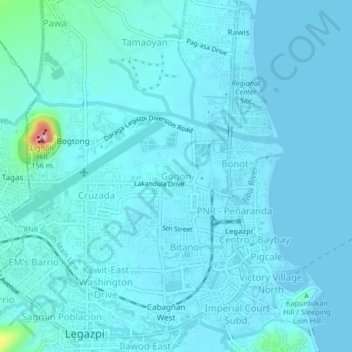
Name: Gogon topographic map, elevation, terrain.

Location: Gogon, Legazpi, Albay, Bicol Region, 4500, Philippines (13.13677 123.72499 13.17677 123.76499)

Average elevation: 12 m

Minimum elevation: 0 m

Maximum elevation: 143 m

Other topographic maps

Click on a map to view its topography, its elevation and its terrain.

Mayon Volcano

Philippines > Albay > Legazpi

Average elevation: 519 m

Sawangan Park

Philippines > Albay > Legazpi

Average elevation: 7 m

Kalayaan Park

Philippines > Albay > Legazpi

Average elevation: 7 m

Gear up for your next adventure:

💧Reusable Water Bottle - Durable water bottles for hydration on trails
🍽️Titanium Camping Spork - Ultralight and indestructible eating utensil
🥾Hiking Gaiters - Protect legs and shoes from mud, snow, and debris
🧤Rechargeable Heated Gloves - Extreme warmth for Canadian winter expeditions
💡LED Headlamp - Hands-free illumination for night hiking and camping

As an Amazon Associate, this site earns from qualifying purchases at no extra cost to you.